


The Nepal Earthquake: An In-Depth Analysis of Its Causes, Impacts, and Recovery
Updated on : 07 January, 2025
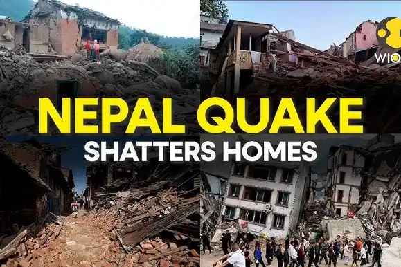
Image Source: Getty Images
Table Of Contents

- 1. Background on Nepal
- 2. Overview of Earthquake-Prone Regions in Nepal
- 3. The Nepal Earthquake (2015)
- 4. Recent Earthquakes Worldwide
- 5. Notable Earthquakes in 2024
- 6. Other Recent Earthquakes
- 7. Geological Causes of the Earthquake
- 8. Impact of the Earthquake
- 9. Humanitarian Crisis
- 10. Cultural and Heritage Loss
- 11. Government and Global Response
- 12. Preparedness and Mitigation Efforts
- 13. Scientific Studies and Research
- 14. Conclusion
Table Of Contents

Background on Nepal
Nepal, officially the Federal Democratic Republic of Nepal, is a landlocked nation in South Asia bordered by China to the north and India to the south, east, and west. It spans an area of approximately 147,516 square kilometers and features diverse geography, from the fertile plains of the Terai region to the towering peaks of the Himalayas, including Mount Everest, the highest point on Earth. Despite its natural beauty, Nepal faces significant economic challenges, with a large portion of its population living below the poverty line. The economy primarily relies on agriculture, tourism, remittances, and international aid.


Overview of Earthquake-Prone Regions in Nepal
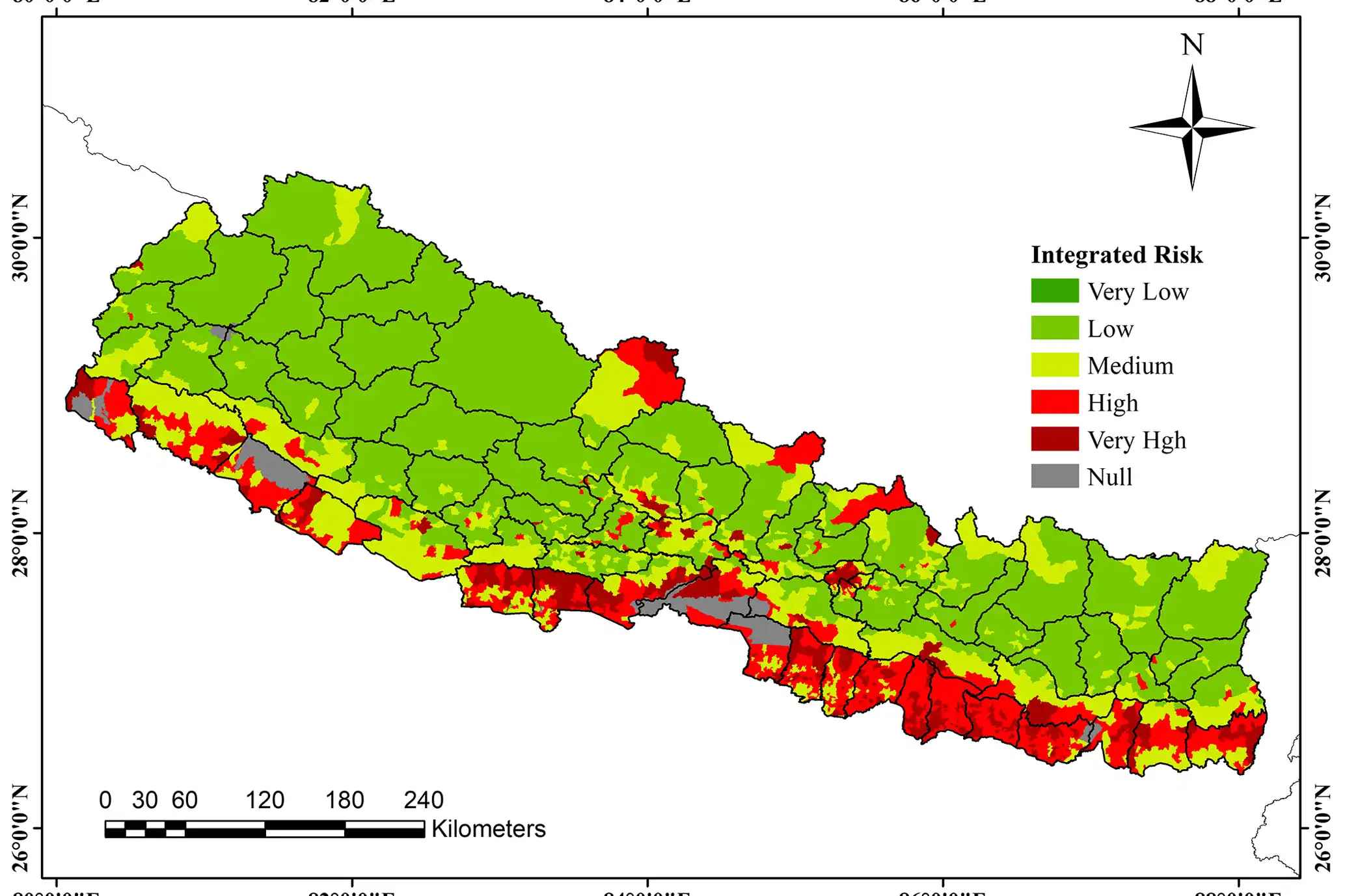
Image Source: copernicus.org
Nepal is situated at a tectonic boundary where the Indian Plate collides with the Eurasian Plate, making it one of the most earthquake-prone countries in the world. The Himalayan region experiences significant seismic activity due to ongoing tectonic movements that generate stress along fault lines. Recent data indicates that Western Nepal is particularly vulnerable, with a series of earthquakes recorded in early January 2025, including a notable 5.2 magnitude quake in Bajura.
Historically, the Gorkha earthquake in April 2015, which measured 7.8 on the Richter scale, caused immense destruction and loss of life, highlighting the region's seismic risks. Experts warn that the accumulation of stress in Western Nepal suggests a high probability of a major earthquake occurring soon, potentially exceeding magnitude 6.0. Additionally, significant energy remains trapped beneath the Kathmandu region, further increasing its vulnerability to powerful seismic events.
Significance of Earthquake Studies
Studying earthquakes is crucial for understanding their causes, predicting future seismic events, mitigating damage, and improving response strategies. Given Nepal's vulnerability to earthquakes, research can help develop better building practices, enhance community preparedness, and inform government policies aimed at disaster risk reduction.

The Nepal Earthquake (2015)
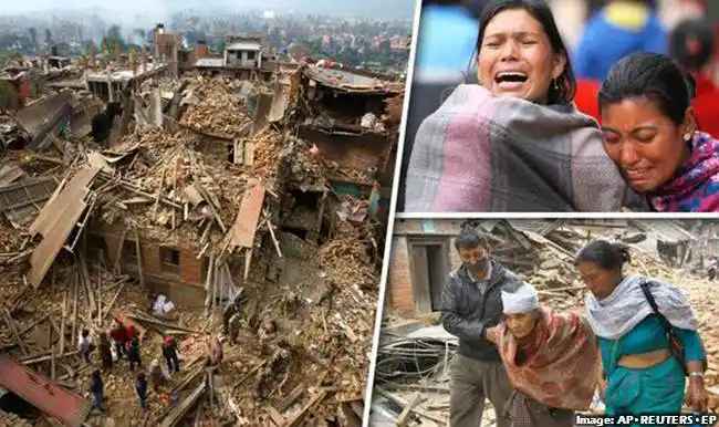
Image Source: merokalam.com
Date and Time of the Event
On April 25, 2015, at approximately 11:56 AM local time (06:11 AM UTC), a catastrophic earthquake struck near Kathmandu, the capital of Nepal. This devastating event marked a significant moment in Nepal's history, as it triggered widespread destruction and loss of life. The earthquake's timing coincided with a period when many people were outside, which may have mitigated some potential casualties. However, the impact was still profound, affecting millions and leading to extensive rescue and recovery efforts in the aftermath.
Magnitude and Epicenter Details
The earthquake registered a moment magnitude of 7.8, making it one of the most powerful earthquakes to hit the region in recent history. Its epicenter was located approximately 34 kilometers east-southeast of Lamjung district and about 77 kilometers northwest of Kathmandu. The quake's focus was about 15 kilometers deep, which is considered shallow and typically results in more severe surface shaking. The intensity of this earthquake was felt not only across central Nepal but also in neighboring countries, highlighting its far-reaching effects on the region.
Regions Affected
The earthquake had a devastating impact across central and western Nepal, with particularly severe effects in regions such as Sindhupalchowk, Gorkha, Dhading, Nuwakot, Rasuwa, and the Kathmandu Valley. The tremors were felt widely, reaching into northern India and even parts of Bangladesh. In total, nearly 9,000 people lost their lives due to the earthquake, with many more injured and millions displaced from their homes. The extensive damage to infrastructure and housing necessitated significant international aid and recovery efforts to assist those affected by this natural disaster.
Popular Blogs

ICC Champions Trophy 2025: Schedule, Teams, Venues & More
on December 25, 2024

World Test Championship 2024-25 Points Table
on December 24, 2024

Aus vs Ind: Border-Gavaskar Trophy 2024 – History & Key Fixtures
on December 14, 2024

Gukesh Dommaraju: Youngest Chess World Champion at 18 Years
on December 13, 2024

GRAP 4 Restrictions in Delhi-NCR: What's Open and Shut?
on December 17, 2024

Russia’s mRNA Cancer Vaccine: A Groundbreaking Step in Oncology
on January 09, 2025

Lulu Mall in India - Complete List of Lulu Malls, and Key Facts
on December 26, 2024
Recent Earthquakes Worldwide
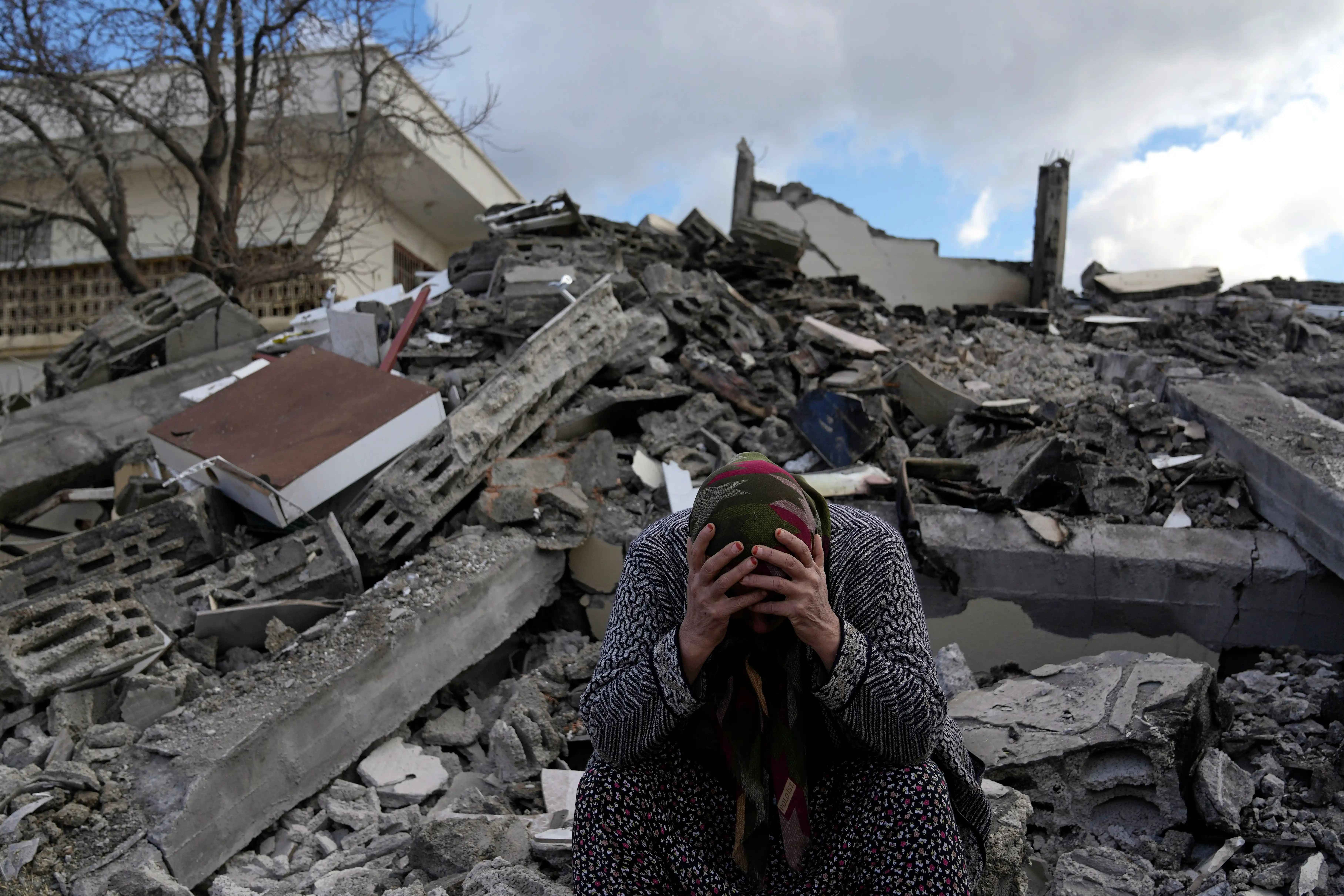
Image Source: npr.org
As of January 7, 2025, the world has experienced significant seismic activity, particularly in regions known for their vulnerability to earthquakes. Here’s a detailed overview of recent earthquakes, including notable events and their impacts.
Earthquake Near the Nepal-Tibet Border
On January 7, 2025, a powerful earthquake measuring 7.1 on the Richter scale struck near the Nepal-Tibet border at approximately 6:35 AM UTC. The epicenter was located 93 km northeast of Lobuche, and the tremors were felt across northern India, including areas such as Delhi and parts of Bihar. Fortunately, there were no immediate reports of significant property damage or casualties, although many residents evacuated buildings during the tremors.
Seismic Activity in Western Nepal
In the weeks leading up to January 7, several smaller earthquakes occurred in Western Nepal. From mid-December 2024 to early January 2025, 10 earthquakes with magnitudes of 4.0 or above were recorded. The strongest of these was a 5.2 magnitude quake on December 20 in Bajura district. Experts have warned that this increased seismic activity may indicate a heightened risk for a major earthquake in the region.
Notable Earthquakes in 2024
Several significant earthquakes occurred globally in 2024:
-
Japan (January 1, 2024): A devastating earthquake with a magnitude of 7.5 struck Ishikawa Prefecture, resulting in 504 fatalities and significant damage to infrastructure.
-
Taiwan (April 2, 2024): A magnitude 7.4 earthquake hit Hualien, causing at least 18 deaths and widespread damage.
-
Vanuatu (December 17, 2024): A magnitude 7.3 earthquake occurred offshore near Port Vila, leading to 14 fatalities.
-
California, USA (December 5, 2024): A magnitude 7.0 earthquake was recorded offshore but resulted in no reported casualties.
-
Indonesia (April 27, 2024): A magnitude 6.5 earthquake struck, causing various degrees of damage but no significant casualties reported.
Other Recent Earthquakes
In addition to the major events listed above, several other notable earthquakes have been recorded:
- On January 3, 2025:
- A magnitude 4.8 earthquake occurred in Southern Sumatra, Indonesia.
- Ethiopia experienced a magnitude 5.2 quake.
- Turkey recorded a magnitude 4.5 earthquake.

Geological Causes of the Earthquake
Tectonic Plate Movements
The seismic activity in Nepal is primarily driven by the collision between the Indian Plate and the Eurasian Plate. The Indian Plate is moving northward at an average rate of approximately 4 to 5 centimeters (about 1.6 to 2 inches) per year, resulting in significant tectonic stress along the boundary where these plates meet. This ongoing convergence is responsible for the uplift of the Himalayan mountain range and contributes to the region's high susceptibility to earthquakes. As the plates interact, they often become stuck due to friction, leading to the accumulation of stress that is eventually released in the form of earthquakes when the stress exceeds frictional resistance.
Major Fault Lines in Nepal
One of the most critical fault lines contributing to seismic activity in Nepal is the Main Himalayan Thrust Fault. This fault plays a significant role in generating earthquakes as it accommodates the compressional forces resulting from the collision of the Indian and Eurasian Plates. Over time, stress builds up along this fault line until it is released suddenly during an earthquake. The April 2015 Gorkha earthquake, which registered a magnitude of 7.8, was a direct result of such thrust faulting along this major fault line. The geological structure of Nepal, characterized by multiple tectonic zones, further complicates the seismic landscape, making it prone to significant earthquakes.
Historical Seismic Activity in the Region
Nepal has a long history of seismic activity, with numerous significant earthquakes recorded over the centuries. While many have caused considerable destruction, none have matched the scale of devastation seen during the Gorkha earthquake in April 2015. This earthquake not only resulted in nearly 9,000 fatalities but also led to extensive damage to infrastructure and cultural heritage sites across the region. Historical data indicates that large earthquakes occur approximately every 750 to 870 years in certain areas of Nepal, suggesting a cyclical pattern of seismic events influenced by tectonic stress buildup. Understanding this historical context is crucial for assessing future earthquake risks and improving preparedness measures in this vulnerable region.

Impact of the Earthquake
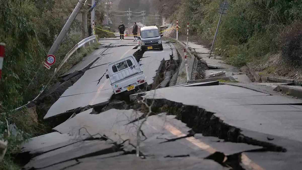
Image Source: euronews.com
Casualties and Injuries Reported
The Gorkha earthquake on April 25, 2015, resulted in nearly 9,000 deaths and injured over 19,000 individuals. The casualties were widespread, affecting various demographics, with a significant proportion of the deceased being women and children. The destruction of buildings and infrastructure was a primary cause of injuries and fatalities, as many people were trapped under collapsed structures during the quake and its aftershocks. The scale of the disaster led to an urgent need for medical assistance and emergency response efforts across the affected regions.
Damage to Infrastructure (Buildings, Roads, Heritage Sites)
The earthquake caused extensive damage to infrastructure throughout Nepal. Over half a million houses were destroyed, leaving millions homeless. Significant damage occurred to cultural heritage sites recognized by UNESCO, including temples and historical monuments that are integral to Nepal's cultural identity. Key infrastructure such as roads was rendered impassable due to landslides triggered by the quake, complicating rescue operations and hindering access to remote areas. Public buildings, schools, and government offices also suffered severe damage, further disrupting essential services.
Economic Impact and Losses
The economic repercussions of the Gorkha earthquake were staggering, with total losses estimated at around $7 billion USD. This figure encompasses damages to housing, infrastructure, and economic activities across various sectors, particularly agriculture and tourism. The housing sector alone accounted for a significant portion of these losses, as many homes lacked seismic-resistant features. The economic strain has had long-lasting effects on families and communities, with many still facing financial burdens related to recovery efforts.
Environmental Consequences (Landslides, Aftershocks)
In the aftermath of the initial quake, numerous aftershocks occurred, some reaching magnitudes above 6.0. These aftershocks triggered additional landslides across mountainous regions, further complicating rescue efforts and causing additional damage to already vulnerable areas. The environmental impact included altered landscapes and increased risk of future landslides, which pose ongoing threats to communities living in affected regions. The combination of seismic activity and environmental degradation has made recovery efforts more challenging for local authorities and humanitarian organizations.
Humanitarian Crisis
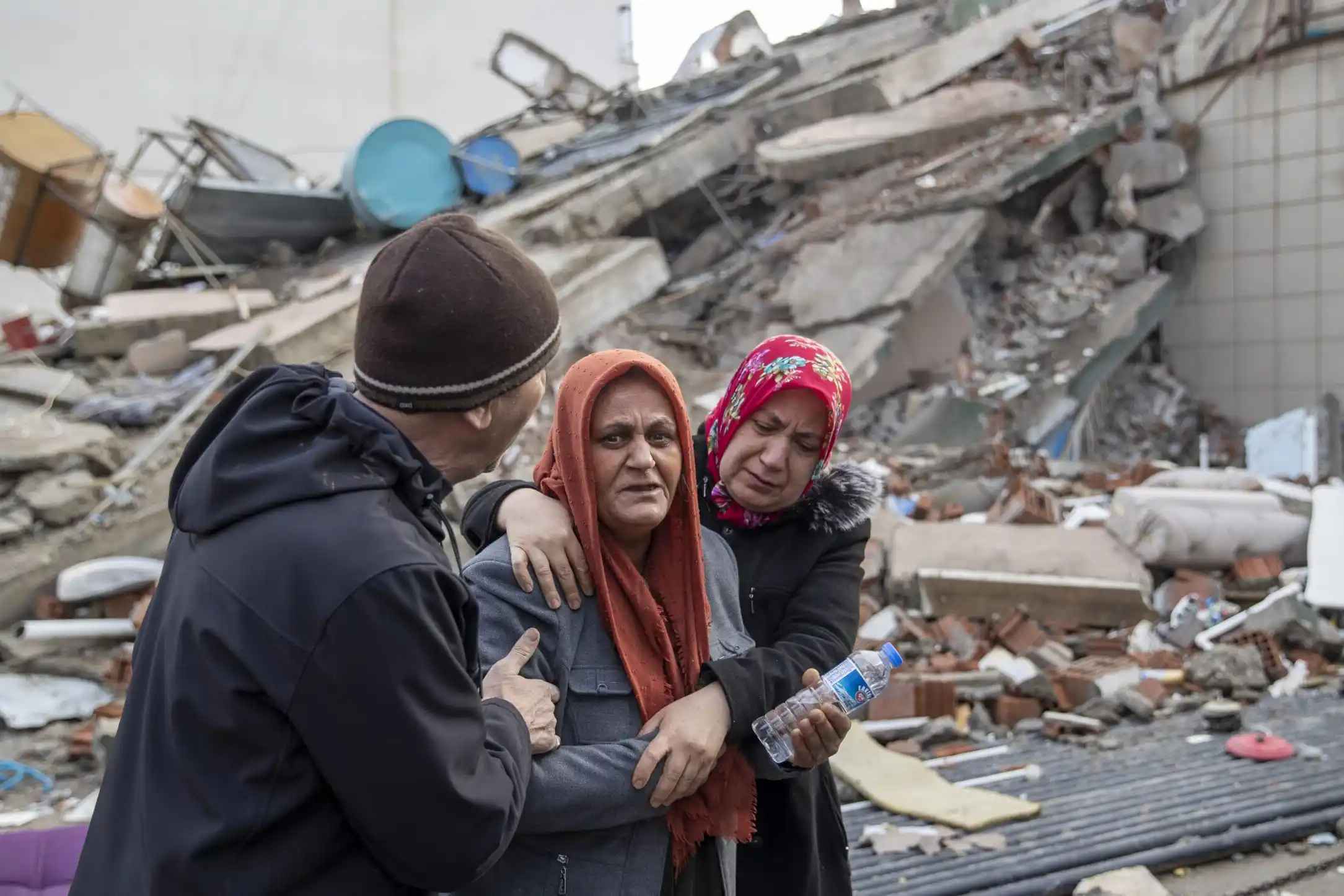
Image Source: hias.org
Displacement of Populations
The Gorkha earthquake on April 25, 2015, led to the displacement of approximately three million people across Nepal. The destruction of homes and infrastructure forced many families to seek shelter in temporary camps or with relatives, significantly impacting their livelihoods and access to essential services. The scale of displacement created a humanitarian crisis, as displaced populations faced challenges in securing food, clean water, and medical care in the aftermath of the disaster.
Emergency Relief Initiatives
In response to the earthquake, international humanitarian organizations mobilized quickly to provide emergency aid. The United Nations launched the Nepal Earthquake Flash Appeal shortly after the disaster, aiming to assist 2.8 million people. However, relief efforts encountered significant challenges due to accessibility issues caused by damaged infrastructure. Many remote areas remained cut off for extended periods, complicating the delivery of essential supplies and medical assistance.
Roles of National and International Organizations
The humanitarian response involved collaboration between local governments and international agencies such as UNICEF, the Red Cross, and various non-governmental organizations (NGOs). These organizations played a crucial role in coordinating relief efforts, providing food, shelter, medical care, and psychological support to affected communities. The involvement of local volunteers and community groups was also vital in facilitating aid distribution and ensuring that assistance reached those in need.
Challenges Faced in Aid Distribution
Logistical challenges significantly hindered timely aid distribution following the earthquake. Many affected areas were located in rugged mountainous terrain, making access difficult for relief teams. Landslides and damaged roads further complicated transportation efforts. During the monsoon season, which began shortly after the quake, many routes became impassable due to flooding and additional landslides. These conditions led to delays in delivering critical supplies and services to remote villages, exacerbating the humanitarian crisis faced by displaced populations.
Cultural and Heritage Loss
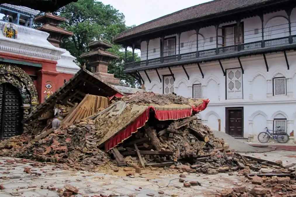
Image Source: Getty Images
Damage to UNESCO World Heritage Sites
The Gorkha earthquake on April 25, 2015, inflicted catastrophic damage on several UNESCO World Heritage Sites in Nepal, particularly within the Kathmandu Valley. Among the most notable losses was the collapse of the iconic Dharahara Tower, a nine-story structure that had stood since 1832. Additionally, many temples within the Kathmandu Valley, including those at the Durbar Squares of Kathmandu, Patan, and Bhaktapur, suffered extensive damage, with estimates indicating that over 80% of historic structures in these areas were destroyed or severely compromised. UNESCO's assessments highlighted that the earthquake resulted in irreversible damage to numerous cultural landmarks that are integral to Nepal's heritage and identity.
Impact on Local Communities and Cultural Practices
The destruction of these cultural sites has had profound repercussions for local communities and their traditional practices. Many of these historical landmarks are not only tourist attractions but also serve as vital centers for cultural and religious activities. The loss of physical structures disrupted festivals, rituals, and daily practices that are closely tied to these sites, leading to a sense of cultural dislocation among residents. Furthermore, the economic impact on communities reliant on tourism has been significant, as many visitors were deterred from traveling to Nepal following the earthquake due to concerns over safety and accessibility. The long-term effects of this loss continue to resonate within communities as they strive to preserve their cultural identity amidst ongoing recovery efforts.
Government and Global Response
Immediate Actions by the Nepal Government
In the wake of the Gorkha earthquake on April 25, 2015, the Nepali government swiftly declared a national emergency to address the immediate needs of affected populations. Rapid assessments were conducted to identify priority areas for aid distribution, allowing for a more organized response to the crisis. Key government institutions, including the Nepal Army, police, and local administrations, were mobilized to coordinate rescue and relief efforts. Despite facing challenges such as limited resources and infrastructure damage, these agencies played a vital role in supporting victims and facilitating aid delivery.
International Aid Efforts and Support
Countries worldwide responded quickly to Nepal's call for assistance. India was one of the first nations to offer substantial support, providing over $1 billion USD in aid shortly after the disaster struck. The Indian government launched Operation Maitri, deploying rescue teams, medical personnel, and relief materials to assist in recovery efforts. Other countries also contributed significantly; for example, Canada pledged CAD $5 million and dispatched a Disaster Assistance Response Team to help coordinate relief operations.
Contributions from NGOs and INGOs
Numerous non-governmental organizations (NGOs) and international non-governmental organizations (INGOs) mobilized rapidly to provide essential services following the earthquake. Field hospitals were established to address medical needs, while search-and-rescue teams were deployed to locate survivors trapped under rubble. Organizations such as UNICEF and the Red Cross played critical roles in coordinating relief efforts, ensuring that food, shelter, and medical care reached those most in need.
Challenges Faced in Aid Distribution
Despite the swift international response, logistical challenges significantly hindered timely aid distribution. Many remote areas remained cut off due to damaged infrastructure and landslides triggered by the earthquake. Access issues complicated the delivery of essential supplies, leaving some communities without adequate assistance for extended periods. Coordination among various actors—government agencies, NGOs, and international organizations—was essential but often complicated by differing priorities and operational challenges on the ground.
Preparedness and Mitigation Efforts
Lessons Learned from the Nepal Earthquake Experience
The Gorkha earthquake of April 2015 highlighted several critical lessons for disaster preparedness and response. One significant takeaway is the importance of early warning systems; had such systems been in place, residents could have received warnings seconds before the quake, potentially saving lives. Additionally, the experience underscored the necessity of building back better, emphasizing that reconstruction efforts must consider future disaster risks to ensure resilience. The effectiveness of the School Earthquake Safety Program (SESP), which retrofitted schools and raised awareness about earthquake safety, demonstrated that proactive measures can significantly reduce damage and casualties during seismic events.
Techniques for Earthquake-Resistant Construction
The earthquake revealed the urgent need for improved construction techniques in Nepal. Retrofits of existing structures, particularly schools, proved effective; out of 300 retrofitted schools, many sustained little to no damage during the quake. Future construction should prioritize seismic-resistant designs, including reinforced materials and adherence to updated building codes that account for local geological conditions. The focus on community-based training for builders and homeowners can also enhance resilience by ensuring that local practices align with modern engineering standards.
Policies for Enhanced Disaster Preparedness
In light of the earthquake's impact, Nepal's government is encouraged to implement comprehensive disaster preparedness policies. This includes establishing robust disaster risk management frameworks, integrating community participation in planning, and enhancing coordination among government agencies and NGOs. Policies should also focus on funding for infrastructure improvements, such as roads and communication systems, to facilitate quicker responses during emergencies. The importance of urban recovery strategies must not be overlooked, as urban areas were significantly affected but often neglected in recovery planning.
Community Awareness Initiatives
Raising community awareness about earthquake preparedness is essential for reducing risks associated with seismic events. Initiatives should include educational programs that teach residents about emergency response procedures, safe building practices, and the importance of having emergency kits. Engaging local leaders and organizations in outreach efforts can foster a culture of preparedness within communities. Moreover, drills and simulations can help familiarize residents with evacuation routes and safety measures, ultimately enhancing community resilience against future earthquakes.
Scientific Studies and Research
Insights Gained from the Nepal Earthquake
The Gorkha earthquake of April 25, 2015, provided valuable insights into seismic behavior and the geological characteristics of the Himalayan region. Researchers found that the earthquake's rupture initiated and halted at two locations where different rock types meet adjacent to the fault, offering clues about the mechanics of fault movement. This data enhances understanding of the Main Himalayan Thrust fault and its role in generating significant earthquakes. Ongoing studies aim to map the entire 1,500-mile length of the Himalayan front to better understand the factors controlling earthquake ruptures and to improve predictive models for future seismic activity.
Advances in Earthquake Prediction and Monitoring Technologies
The earthquake prompted advancements in earthquake prediction and monitoring technologies. The Advanced Rapid Imaging and Analysis (ARIA) project, a collaboration between NASA’s Jet Propulsion Laboratory and Caltech, developed automated systems to process seismic data more efficiently. This technology allows for rapid generation of interferograms that visualize ground deformation caused by earthquakes. By utilizing satellite data from missions like the European Union’s Copernicus Sentinel-1A, scientists can quickly assess ground motion and develop detailed models of fault behavior, which are crucial for understanding potential future earthquakes.
Role of Technology in Disaster Management
Technology played a critical role in disaster management during and after the Gorkha earthquake. The integration of satellite imagery, data processing systems, and collaborative mapping efforts allowed for effective monitoring of landslides and structural damage. For instance, a broad international collaboration utilized advanced satellite imagery to map over 4,300 landslide occurrences following the quake. This comprehensive approach facilitated timely assessments of disaster impact and informed recovery strategies. Enhanced communication technologies also improved coordination among local governments, NGOs, and international agencies during relief efforts.
Conclusion
In conclusion—while lessons learned from past experiences provide valuable insights informing future preparedness initiatives aimed at minimizing risks associated with living within high seismic zones like those found throughout much country today still facing ongoing threats posed by future earthquakes looming ahead potentially at any time without warning signs beforehand indicating imminent danger approaching rapidly towards them unexpectedly catching everyone off guard entirely unprepared when it finally arrives inevitably someday soon enough! Continued efforts focused upon enhancing awareness levels among citizens regarding potential risks associated with living within these areas remain crucial towards fostering resilience among communities facing uncertainties ahead!

 Properties for Rent in GurugramProperties for Rent in DelhiProperties for Rent in FaridabadProperties for Rent in KolkataProperties for Rent in PuneProperties for Rent in Greater NoidaProperties for Rent in JaipurProperties for Rent in AhmedabadProperties for Rent in BengaluruProperties for Rent in Lucknow