


6.9-Magnitude Earthquake Hits Japan, Tsunami & Earthquake Warnings Issued
Updated on : 14 January, 2025
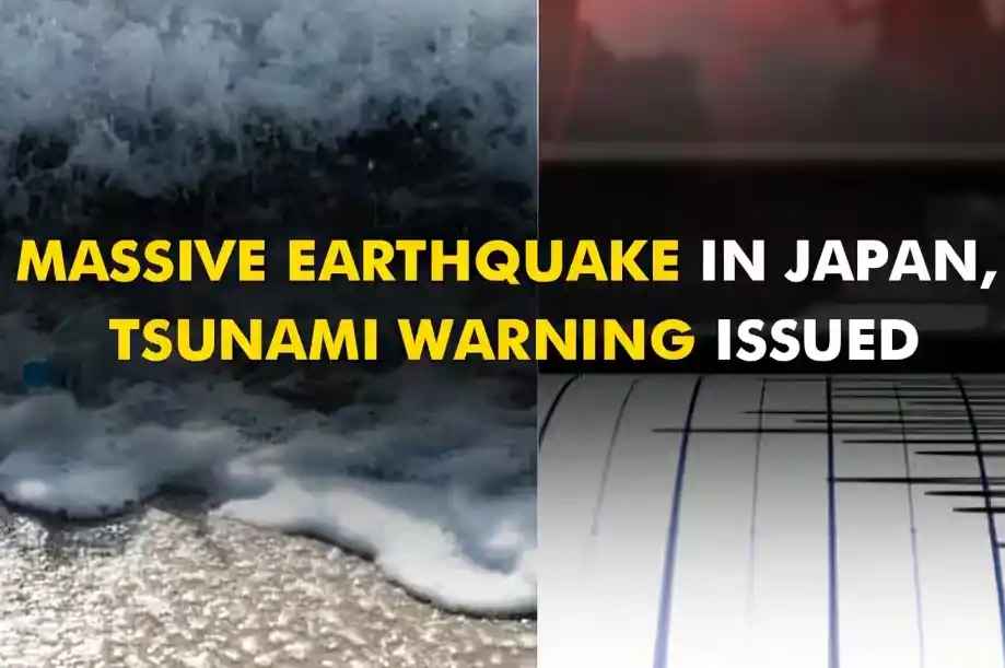
Image Source: zeenews
Table Of Contents

- 1. Overview of Japan's Earthquake and Tsunami Warning System
- 2. Official Advisory by Japan Meteorological Agency
- 3. Structure of Earthquake Warning System
- 4. Structure of the Tsunami Warning System
- 5. Types of Tsunami Warnings Issued
- 6. Main Tectonic Plates Involved in Japan's Earthquakes
- 7. Impact of the Ring of Fire on Japan's Earthquake Frequency
- 8. Effect of the Ring of Fire on Volcanic Eruptions in Japan
- 9. Role of Sea-Bed Bottom Pressure Recorders in Japan's Tsunami Warning System
- 10. Speed of Issuing Warnings in Japan's Tsunami Warning System
- 11. Improvements to Japan Tsunami Warning System After the 2011 Disaster
- 12. Recent Earthquake Events
- 13. Japan Meteorological Agency and Earthquake Severity Determination
- 14. Predicting the Likelihood of Major Earthquakes in Japan
- 15. Influence of the b-Value on Earthquake Predictions in Japan
- 16. Measures to Mitigate the Impact of Earthquakes in Japan
- 17. Preparation of Coastal Residents for Tsunami Warnings
- 18. Potential Long-Term Effects of Frequent Earthquakes on Japan's Infrastructure
- 19. Comparison of Japan's Tsunami Warning System with Other Countries
- 20. Effectiveness of Japan's Tsunami Warning System in Recent Years
- 21. Conclusion
Table Of Contents

A powerful earthquake with a magnitude of 6.9 recently struck southwestern Japan, raising concern in the area. Japan is in an earthquake-prone zone, which makes such events common. This emphasizes the need for Japan's advanced warning systems, which play a key role in keeping people safe and minimizing damage during earthquakes and tsunamis.


Overview of Japan's Earthquake and Tsunami Warning System
Japan's earthquake and tsunami warning system is primarily managed by the Japan Meteorological Agency (JMA). This agency plays a crucial role in monitoring seismic activity and issuing timely warnings to the public. The system is designed to quickly detect earthquakes, assess their potential impact, and communicate necessary information to residents.
Official Advisory by Japan Meteorological Agency
The Japan Meteorological Agency (JMA) issued a warning of potential tsunami waves reaching up to one meter (three feet) and advised the public to avoid coastal areas.
"Tsunamis can occur multiple times. Please stay out of the sea and away from coastal regions," the JMA stated on X.
Japan Meteorological Agency (JMA) Press Release
Regarding the Nankai Trough earthquake temporary information (survey completed) announced at 23:45 on January 13, 2020, a press conference held from 00:15 on the January 14th.
Structure of Earthquake Warning System
- Seismic Sensors: Detect ground shaking and measure seismic waves. These sensors are strategically placed across the country for comprehensive coverage.
- Data Processing Algorithms: Analyze data from sensors to determine the earthquake's magnitude, depth, and location, enabling timely alerts.
- Communication Infrastructure: Disseminates alerts through various channels, including television, radio, mobile phones, and social media.
- Public Alert Systems: Operated by the Japan Meteorological Agency (JMA), these systems send emergency notifications seconds before strong tremors hit.
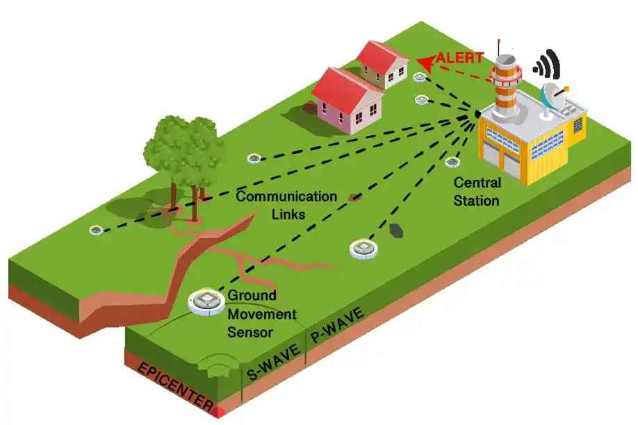
Image Source: Research Gate
Structure of the Tsunami Warning System
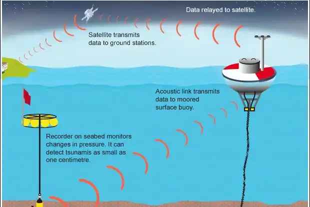
Image Source: Research Gate
The tsunami warning system is an integral part of Japan's disaster preparedness strategy. It operates alongside the earthquake early warning system to provide comprehensive coverage.
Popular Blogs

ICC Champions Trophy 2025: Schedule, Teams, Venues & More
on December 25, 2024

World Test Championship 2024-25 Points Table
on December 24, 2024

Aus vs Ind: Border-Gavaskar Trophy 2024 – History & Key Fixtures
on December 14, 2024

Gukesh Dommaraju: Youngest Chess World Champion at 18 Years
on December 13, 2024

GRAP 4 Restrictions in Delhi-NCR: What's Open and Shut?
on December 17, 2024

Russia’s mRNA Cancer Vaccine: A Groundbreaking Step in Oncology
on January 09, 2025

Lulu Mall in India - Complete List of Lulu Malls, and Key Facts
on December 26, 2024
How It Works
-
Detection: When an earthquake occurs, seismographs detect ground shaking and send data to the JMA.
-
Assessment: The JMA evaluates the earthquake's magnitude, depth, and potential for generating a tsunami. This assessment is usually completed within minutes.
-
Issuance of Warnings: If a tsunami is likely, the JMA issues warnings categorized by severity.
-
Public Alerts: Warnings are communicated through multiple platforms to ensure widespread awareness among residents in affected areas.
Types of Tsunami Warnings Issued
| Warning Type | Japanese Name | Expected Wave Height | Action Required |
|---|---|---|---|
| Major Tsunami Warning | 大津波警報 | Greater than 3 meters | Evacuate immediately to high ground |
| Tsunami Warning | 津波警報 | Up to 3 meters | Evacuate from coastal areas; flooding expected |
| Tsunami Advisory | 津波注意報 | Up to 1 meter | Leave coastal areas; strong currents may pose risks |
Main Tectonic Plates Involved in Japan's Earthquakes
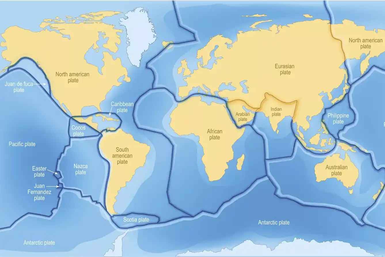
Image Source: thoughtco.com
Japan is located at the convergence of several major tectonic plates:
-
Pacific Plate: This plate is moving northwestward and is responsible for many significant earthquakes in Japan.
-
Philippine Sea Plate: Located south of Japan, this plate interacts with both the Eurasian Plate and other surrounding plates.
-
Eurasian Plate: This continental plate forms part of Asia and plays a critical role in seismic activity due to its interactions with neighboring plates.
-
Okhotsk Plate: Underlying northern Japan, this plate also contributes to seismic events through its interactions with other tectonic boundaries.
Tectonic Plates Affecting Japan
| Tectonic Plate | Description |
|---|---|
| Pacific Plate | Major contributor to earthquakes; moving northwest |
| Philippine Sea Plate | Interacts with Eurasian Plate; located south of Japan |
| Eurasian Plate | Forms part of Asia; involved in numerous seismic events |
| Okhotsk Plate | Underlies northern Japan; interacts with Pacific Plate |
Impact of the Ring of Fire on Japan's Earthquake Frequency
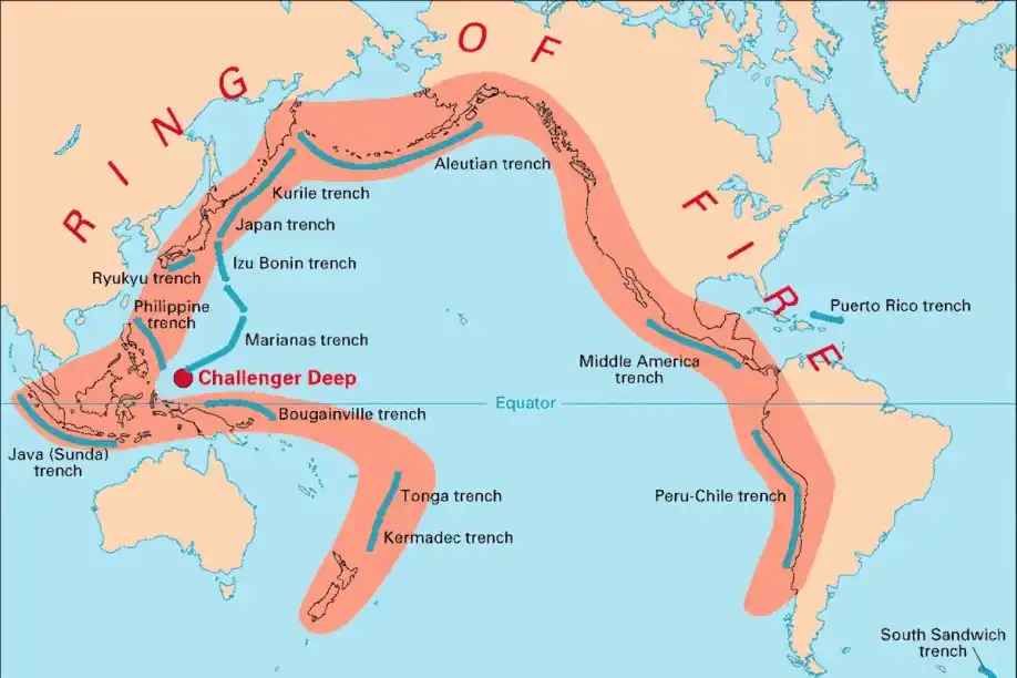
Image Source: Indian Express
Japan's location along the Pacific "Ring of Fire" significantly influences its earthquake frequency. The Ring of Fire is an area characterized by numerous volcanoes and earthquake sites due to tectonic plate movements.
Key Points
-
High Seismic Activity: Japan experiences thousands of earthquakes each year because it lies on this tectonic boundary. While many are minor, they serve as indicators of ongoing geological activity.
-
Major Earthquakes: The Ring of Fire has produced some of the largest recorded earthquakes globally, including Japan’s own Tōhoku earthquake in 2011.
Effect of the Ring of Fire on Volcanic Eruptions in Japan
In addition to earthquakes, Japan’s position on the Ring of Fire also contributes to its volcanic activity:
-
Volcanic Eruptions: The subduction zones associated with tectonic plate interactions lead to melting rock that can result in volcanic eruptions.
-
Active Volcanoes: Japan has several active volcanoes due to this geological context, including Mount Fuji and Mount Sakurajima.
Notable Active Volcanoes in Japan
| Volcano Name | Location | Last Eruption |
|---|---|---|
| Mount Fuji | Honshu Island | 1707 |
| Mount Sakurajima | Kyushu Island | Ongoing |
| Mount Aso | Kyushu Island | Ongoing |
Role of Sea-Bed Bottom Pressure Recorders in Japan's Tsunami Warning System
Sea-bed bottom pressure recorders are crucial components of Japan's tsunami warning system:
-
Functionality: These devices measure changes in water pressure at the ocean floor. A sudden increase can indicate an approaching tsunami wave.
-
Real-Time Data: The information collected is transmitted back to monitoring stations on land, allowing for rapid assessments following seismic events.
Speed of Issuing Warnings in Japan's Tsunami Warning System
One of the standout features of Japan’s tsunami warning system is its speed:
-
Rapid Detection: The JMA can issue warnings within minutes after detecting an earthquake.
-
Timeliness Saves Lives: Quick alerts allow residents in coastal areas time to evacuate or take protective measures before waves reach shore.
Timeline for Issuing Warnings
| Step | Timeframe |
|---|---|
| Earthquake Detection | Immediate (within seconds) |
| Initial Assessment | Within 1-3 minutes |
| Warning Issuance | Within 3-5 minutes |
Improvements to Japan Tsunami Warning System After the 2011 Disaster
The catastrophic Tōhoku earthquake and tsunami in 2011 prompted significant improvements to Japan’s warning systems:
-
Enhanced Technology: Investments were made in advanced seismic monitoring equipment and tsunami detection technologies.
-
Public Education Campaigns: Increased focus on educating citizens about emergency preparedness and evacuation procedures has been implemented since 2011.
-
Improved Communication Systems: Efforts have been made to ensure that warnings reach all residents quickly through various channels, including mobile alerts and social media platforms.

Recent Earthquake Events
Recent Earthquake Events
Recent notable earthquake events in Japan include:
- 2011 Tohoku Eartquake: A magnitude 9.0-9.1 earthquake occurred in the Pacific Ocean, approximately 72 km (45 miles) east of the Oshika Peninsula in the Tōhoku region.
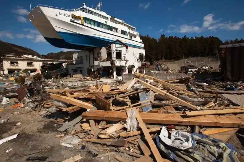
Image Source: Temblor
- 2016 Kumamoto Earthquakes: A series of strong earthquakes struck Kyushu, causing significant damage and fatalities.
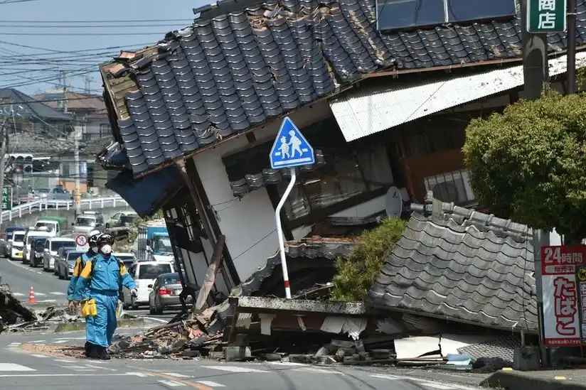
Image Source: bbci
- 2021 Fukushima Earthquake: A magnitude 7.3 earthquake off the coast of Fukushima was an aftershock of the 2011 Tōhoku earthquake.
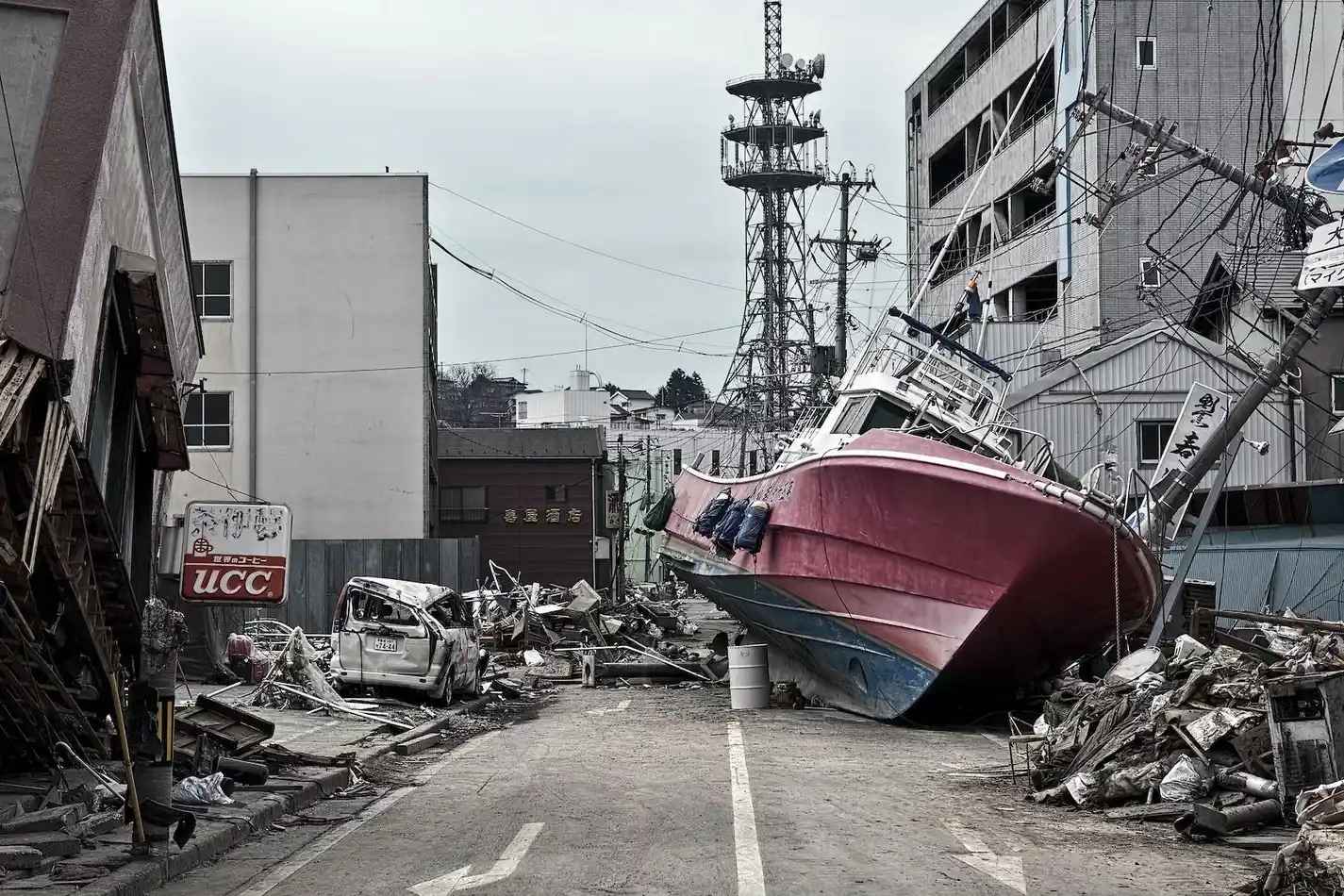
Image Source: Stanford
- 2022 Ibaraki Earthquake: A magnitude 6.1 earthquake shook eastern Japan, reminding residents of the constant seismic risks.
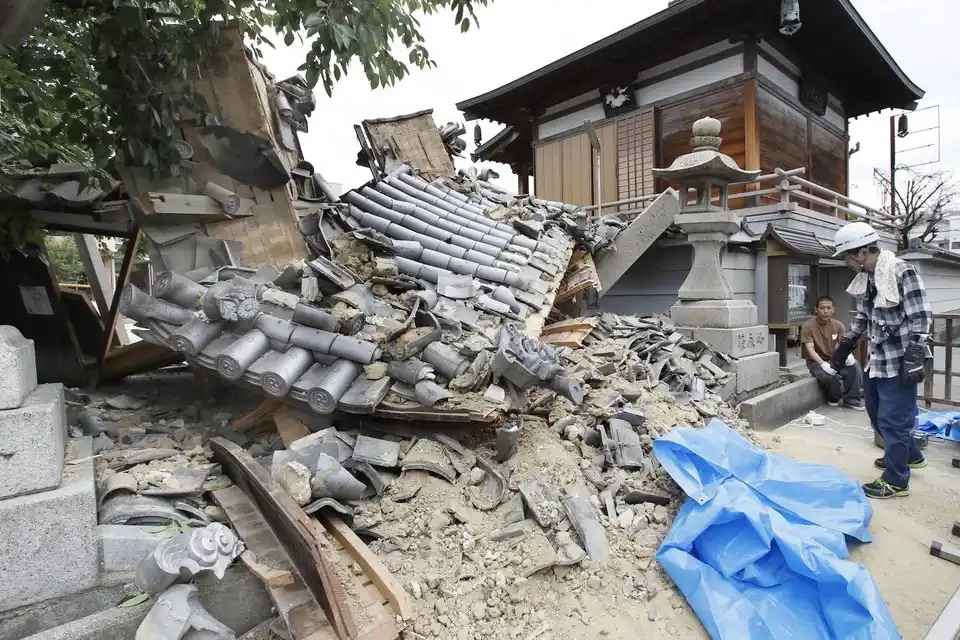
Image Source: Wall Street Journal
- 2025 Nankai-Trough Earthquake:A magnitude 6.9 earthquake struck southwestern Japan, near Miyazaki Prefecture on the island of Kyushu.
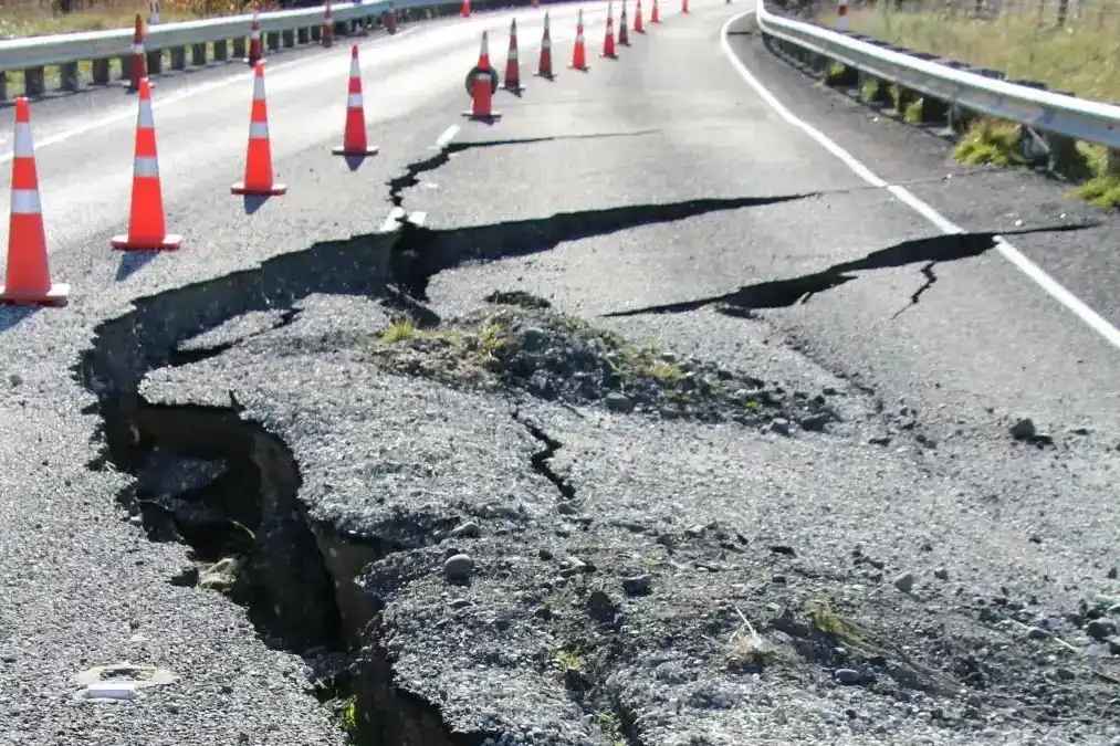
Image Source: India Tv
These events underscore the importance of Japan’s advanced warning systems and preparedness measures.systems in responding promptly.
Japan Meteorological Agency and Earthquake Severity Determination
The JMA employs several methods to assess earthquake severity:
- Seismic Intensity Scale (Shindo): The JMA uses its own scale that ranges from 0 (not felt) to 7 (very strong). This scale measures ground shaking at various locations rather than just overall energy release.
JMA Seismic Intensity Scale Overview
| Intensity Level | Description |
|---|---|
| 0 | Not felt |
| 1 | Weak shaking; felt by a few people |
| 2 | Light shaking; felt by many |
| 3 | Moderate shaking; many people awake |
| 4 | Strong shaking; noticeable movement |
| 5 | Very strong shaking; some structural damage |
| 6 | Disastrous shaking; severe damage |
| 7 | Extremely severe shaking; catastrophic damage |
Predicting the Likelihood of Major Earthquakes in Japan
Predicting earthquakes remains challenging due to their complex nature; however, scientists use several methods:
-
Historical Data Analysis: By studying past earthquakes' locations and magnitudes, scientists can identify patterns that may indicate future risks.
-
Geological Studies: Research into fault lines helps scientists understand where stress accumulates over time.
-
Monitoring Technology: Continuous monitoring using GPS stations allows scientists to observe ground movements that may indicate increased seismic risk.
Influence of the b-Value on Earthquake Predictions in Japan
The b-value is a statistical measure used in seismology:
-
Definition: The b-value represents the relationship between small and large earthquakes within a given region. A lower b-value indicates a higher likelihood of larger earthquakes occurring relative to smaller ones.
-
Application: In Japan, scientists analyze b-values across different regions to assess seismic hazards better. Changes in b-values can signal shifts in stress accumulation along fault lines, informing predictions about potential large-scale events.
Measures to Mitigate the Impact of Earthquakes in Japan
Japan has implemented numerous strategies aimed at reducing earthquake impacts:
-
Building Codes: Stricter building regulations ensure that structures can withstand seismic forces, minimizing damage during earthquakes.
-
Public Education Campaigns: Ongoing education programs inform citizens about emergency preparedness measures, including evacuation routes and safety protocols during quakes or tsunamis.
-
Disaster Drills: Regularly scheduled drills help communities practice their responses during emergencies, ensuring readiness when real events occur.
Preparation of Coastal Residents for Tsunami Warnings
Residents living in coastal areas take specific steps to prepare for potential tsunamis:
-
Evacuation Routes: Many communities have designated evacuation routes leading to higher ground or safe zones away from coastlines. Residents are encouraged to familiarize themselves with these paths ahead of time.
-
Emergency Kits: Preparing emergency kits with essential supplies—such as food, water, medications—ensures families are ready for any situation following an evacuation order.
-
Community Awareness Programs: Local governments often conduct workshops or informational sessions about tsunami risks tailored specifically for coastal populations.
Potential Long-Term Effects of Frequent Earthquakes on Japan's Infrastructure
Frequent seismic activity poses several long-term challenges for Japan’s infrastructure:
-
Structural Damage: Continuous shaking can weaken buildings over time even if they initially meet safety standards. Regular assessments are necessary for maintaining structural integrity.
-
Economic Impact: Rebuilding after major quakes incurs significant costs for local governments and businesses alike. Infrastructure repairs can strain budgets over time if disasters occur frequently.
Long-Term Effects on Infrastructure
| Effect | Description |
|---|---|
| Structural Damage | Weakened buildings requiring regular assessments |
| Economic Strain | High costs associated with rebuilding efforts |
| Psychological Impact | Increased anxiety among residents regarding future quakes |
Comparison of Japan's Tsunami Warning System with Other Countries
Japan’s tsunami warning system is among the most advanced globally but can be compared with systems from other countries prone to similar risks:
Comparison with Other Countries' Systems
| Country | Warning System Features |
|---|---|
| Indonesia | Uses seismic buoys; less comprehensive coverage |
| Chile | National alert systems; focuses on public education |
| United States | Regional alerts via NOAA; relies heavily on technology |
While each country has developed its own approach based on local conditions and historical experiences, Japan stands out due to its rapid response capabilities and extensive public education efforts regarding disaster preparedness.

Effectiveness of Japan's Tsunami Warning System in Recent Years
Japan’s tsunami warning system has proven effective over recent years:
-
After improvements post-2011 disaster, response times have decreased significantly.
-
Public awareness campaigns have led more citizens to understand evacuation procedures better during emergencies.
Despite these advancements, challenges remain as new technologies continue evolving alongside changing environmental conditions that may affect future risks.
Conclusion
Japan's earthquake and tsunami warning systems exemplify proactive disaster preparedness strategies designed to protect lives amid ongoing seismic threats. By leveraging advanced technology alongside public education initiatives, Japan continues striving towards minimizing risks associated with natural disasters while enhancing community resilience against future challenges. Understanding these systems' intricacies empowers residents—ultimately fostering safer environments throughout this geologically active nation.

 Properties for Rent in GurugramProperties for Rent in DelhiProperties for Rent in FaridabadProperties for Rent in KolkataProperties for Rent in PuneProperties for Rent in Greater NoidaProperties for Rent in JaipurProperties for Rent in AhmedabadProperties for Rent in BengaluruProperties for Rent in Lucknow